Passport
- High-altitude class
- Tian Shan, Tengri Tagh ridge
- Khan Tengri peak, 6995 m, via the right part of the East face
- Proposed - 6B cat. sl. first ascent
- Elevation gain: 1865 m, route length - 2280 m.
Length of sections with 5-6 cat. sl. - 1270 m. Average steepness of the main part of the route is 64° (5220-6795), including 6 cat. sl. sections: 80° (5550-5570), 85° (5730-5755), 85° (5855-5865), 90° (6135-6155), 80° (6580-6590), 85° (6720-6760).
- Pitons used:
| Rock | Bolt | Nut | Ice |
|---|---|---|---|
| 42/4 | 0/0 | 12 (incl. 7 ice anchors) | 143/13 |
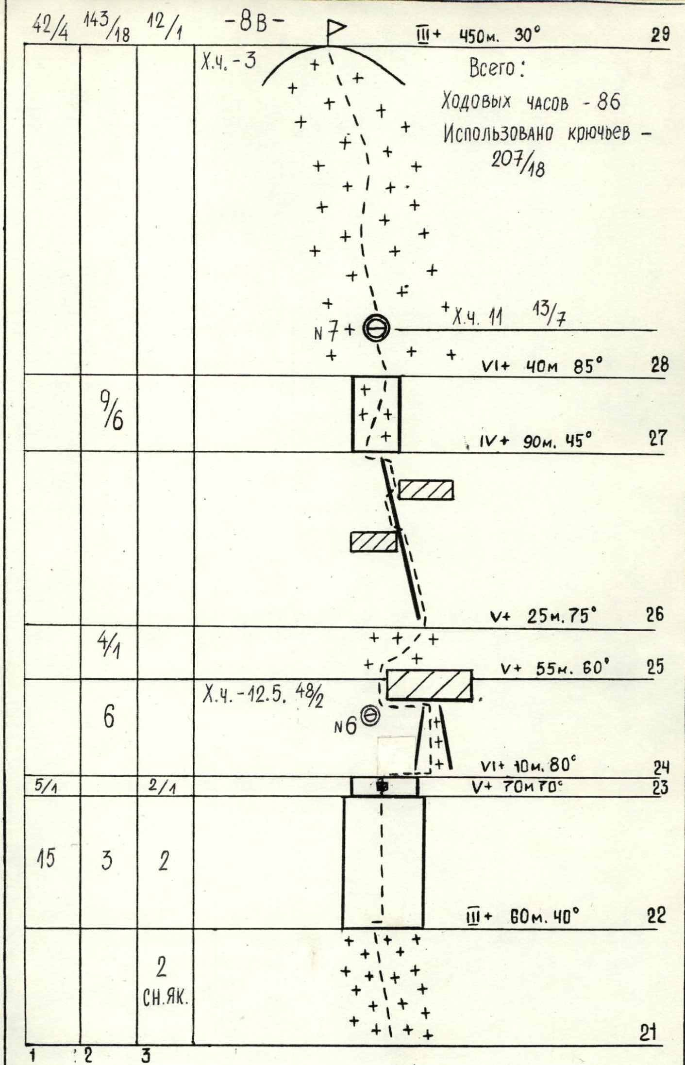
- Team's total climbing hours: 86 hours and 8 days
- Overnights: 1st - sitting on an ice ledge; 2nd - on an ice ridge; 3rd - on a snow ridge; 4th - on an ice ridge; 5th - on a snow pad; 6th - on a snow slope; 7th - on the summit dome on a snow slope.
- Team leader: Savin Alexander Borisovich, MS
Team members: Yablinsky Vladimir Iosifovich, CMS Uruzgaliev Anatoly Alekseevich, MS Shegay Arthur Rodionovich, CMS Kushaev Renat Gayazovich, CMS Popsulin Igor Anatolyevich, CMS Bryakin Sergey Vasilyevich, CMS Galiev Murat Shakhtmanovich, CMS
- Coach: Popenko Yuri Stepanovich, MSMS, Honored Coach of the Kazakh SSR
- Approach to the route: August 13, 1988.
Reached the summit - August 23, 1988. Returned - August 25, 1988.
- Organization: State Sports Committee of the Kazakh SSR
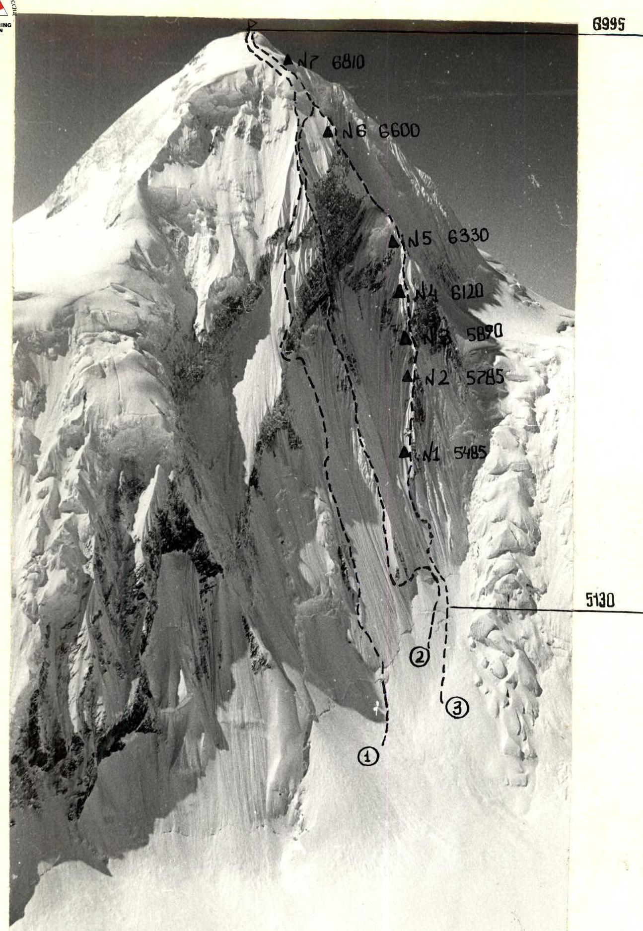
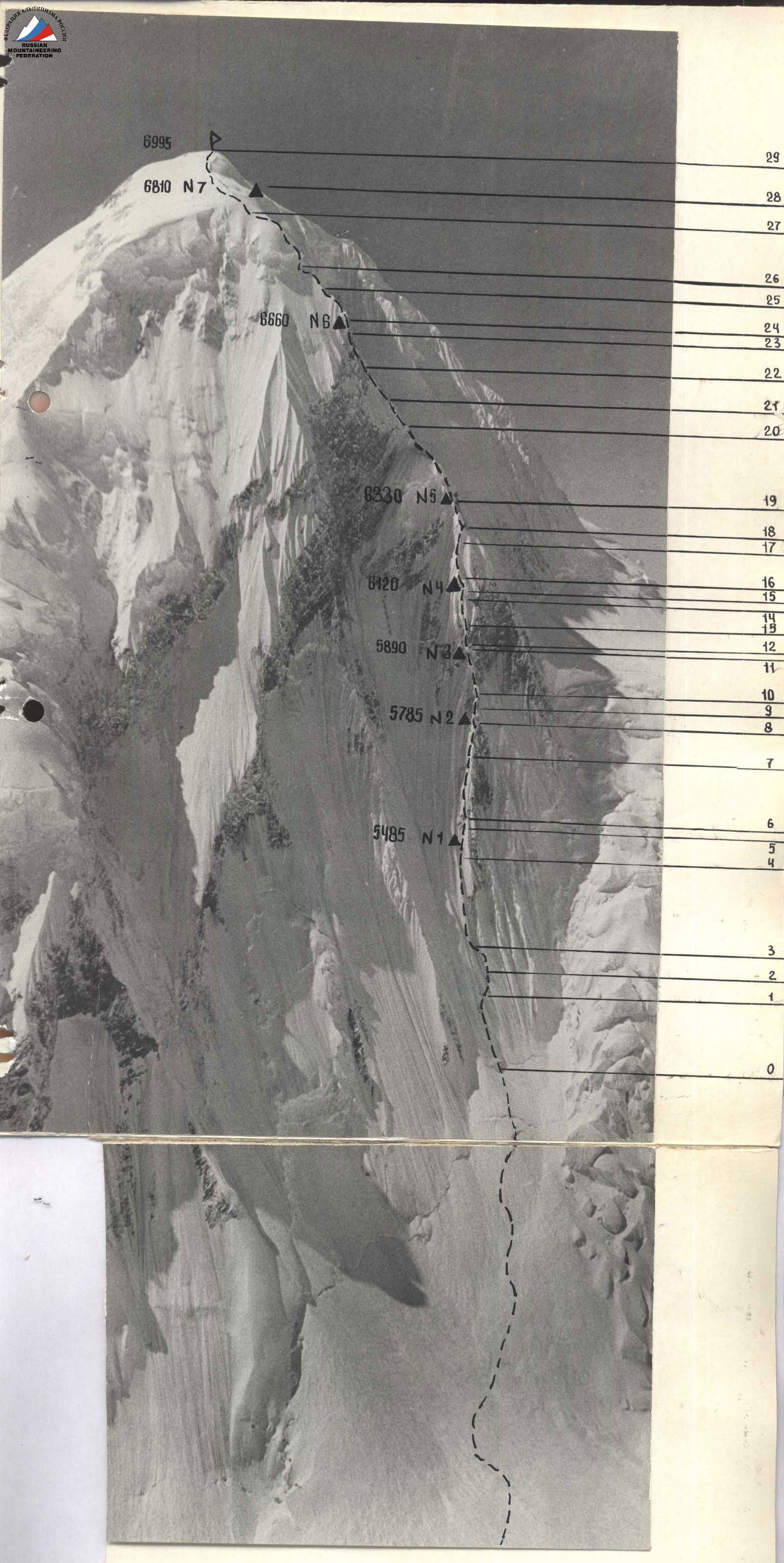
General photo of the summit
August 30, 1988, 16:00, "Canon" lens, F = 50 mm, distance - 1 km, from a helicopter, H = 5800
- 1987 route, 5B cat. sl.
- 1988 route of the team from the Kyrgyz Sports Committee
- Team's route
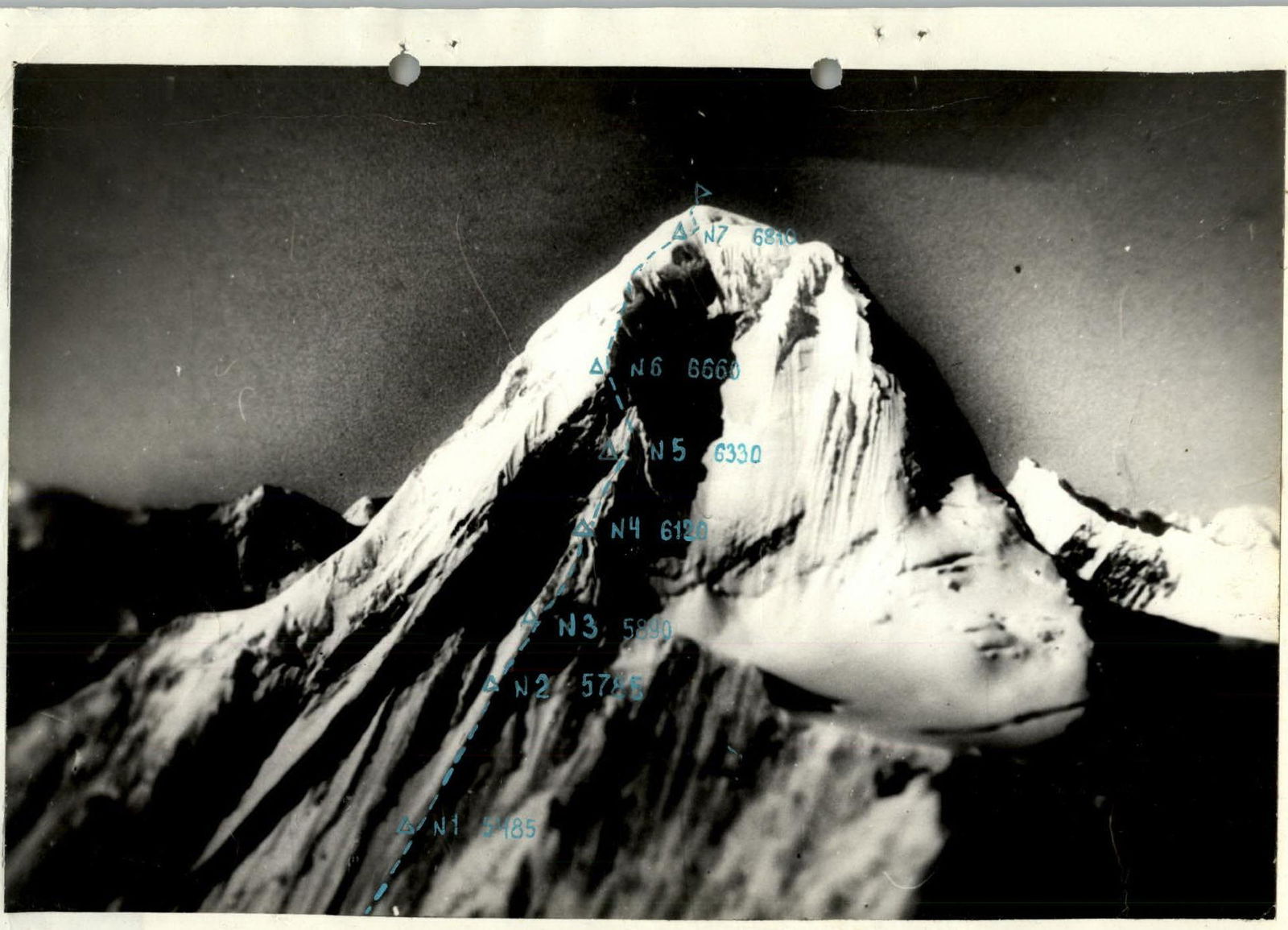
Photo of the route profile from the right. August 5, 1988, 14:00, "Industar-50" lens, F = 50, distance 1.5 km, from a helicopter, H = 6100 m.
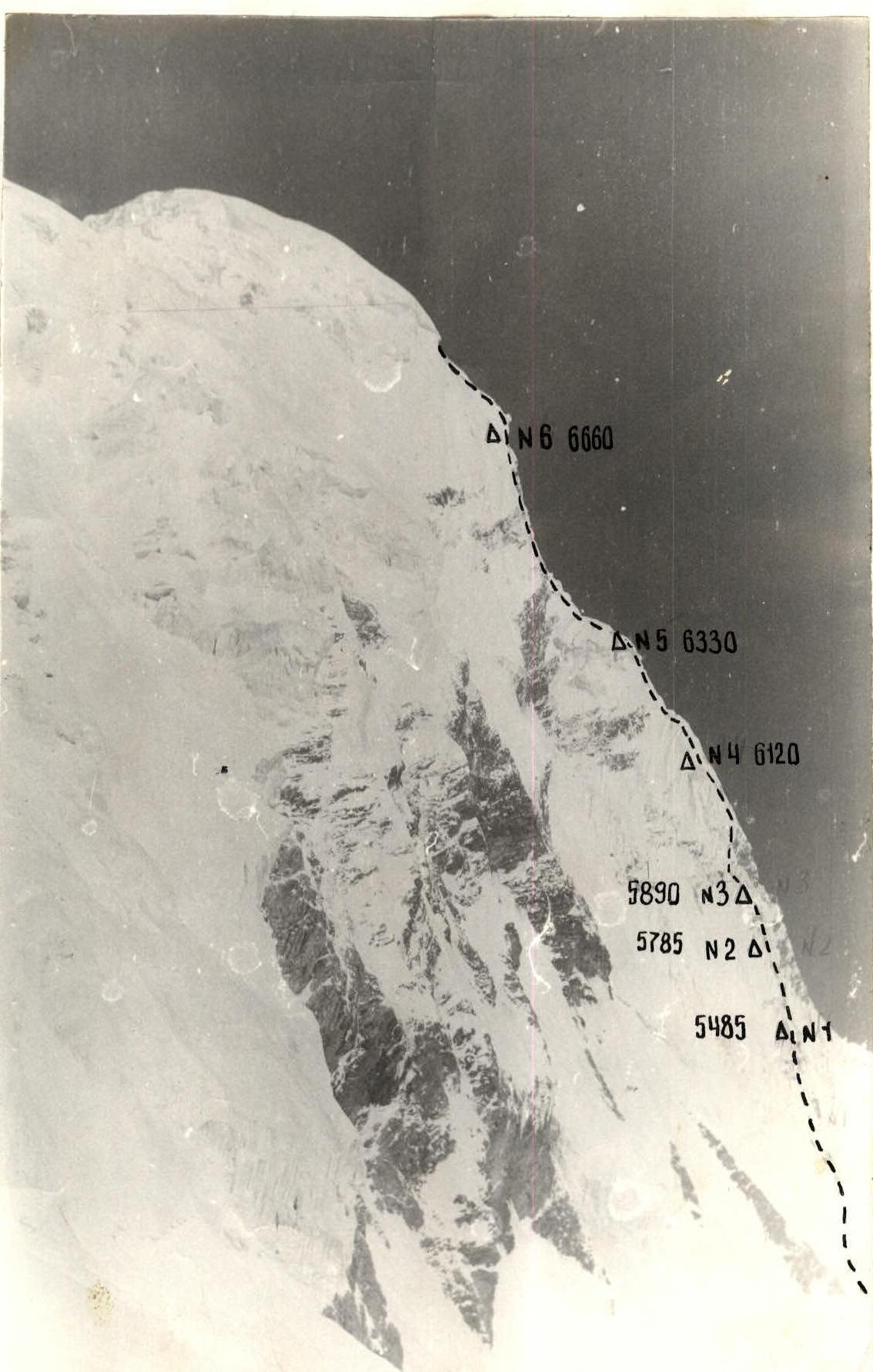
Photo of the route profile from the left. August 5, 1988, 14:00, "Industar-50" lens, F = 50, distance 1.5 km, from a helicopter, H = 5900 m.
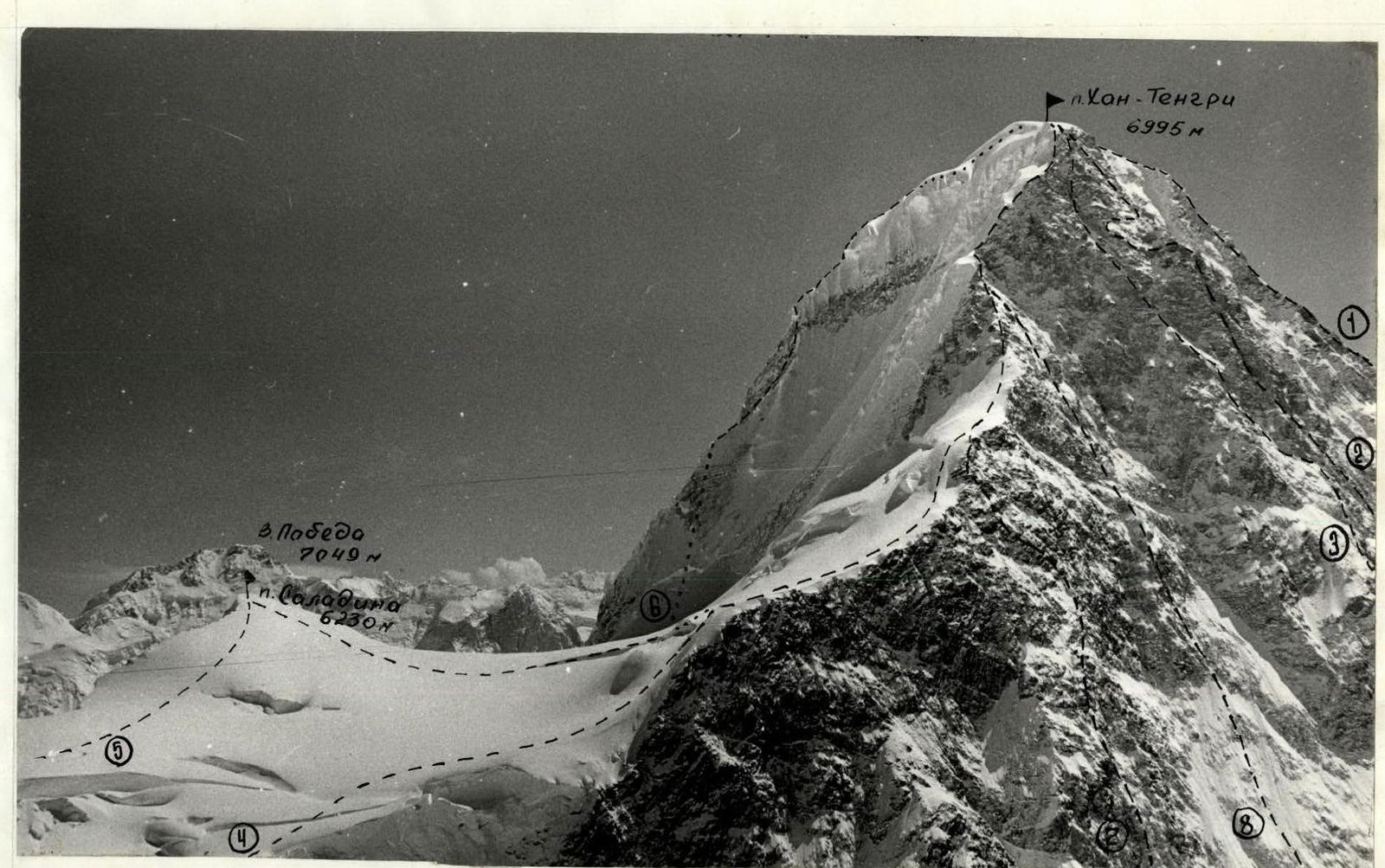
Photopanorama of the area
August 30, 1988, 16:00, "Canon" lens, F = 50, distance 1 km, from a helicopter H = 5800. Routes:
- Route via the SW slope, 5B, 1931, Pogrebetsky
- Route via the center of the N face, 5B, 1974, Mylovsky
- Route via the center of the N face, 5B, 1974, Studenin
- Route via the N ridge, 5B, 1964, Kuzmin
- Traverse of 6 peaks, 5B, 1974, Solomatov
- Route via the right part of the E face, 6B, 1988, Savin
- Route via the E part of the N face, 5B, 1970, Khudyakov
- Route via the E part of the N ridge, 5B, 1975, Benkin
Brief overview of the climbing area
Khan Tengri peak, whose East face the team's route followed, is located in the Tengri Tagh ridge of Central Tian Shan.
Khan Tengri peak is well-trodden by climbers. Many routes of 5B and 6 cat. sl. have been laid along its northern, western, and southern slopes. Only the eastern face remained untouched until recently. The first route through it was made by a team from Leningrad in 1987. The approach to the E face is labor-intensive and time-consuming - 6-8 climbing hours from the base camp under the slopes of Peak M. Gorky. The path lies through the Inylchek glacier towards Peak Slantsev, which is bypassed on the right, avoiding the icefall, and then along the Razorvaniy glacier. Before entering the eastern cirque, one must find passages through the steeply sloping part of the Razorvaniy glacier. The eastern cirque is framed from east to west by the eastern face of Khan Tengri, the northern slopes of Peak Saladin, and the western slopes of Peak Shatter. The elevation of the cirque is between 4850-4950 m. The cirque heats up significantly in sunny weather. Rising thermal air currents form intricate ridges, particularly on the eastern slopes of Khan Tengri, making it challenging for climbers to move and establish belays. Due to its exposure, the eastern face of Khan Tengri begins to receive sunlight at 7:30 AM. By 4:00 PM, the sun hides behind the ridge extending from Khan Tengri to the SSE. The outside air temperature drops below 0°C.
Tactical actions of the team
The tactical plan envisioned completing the route in 7 climbing days. It included 6 planned overnights and one reserve overnight at an altitude of 5750 m, as well as 2 days for bad weather. The team largely adhered to this tactical plan. The route was completed in 10 days, with 3 days spent waiting out bad weather. On the final day, August 23, the journey from the overnight to the summit took 1 hour and 30 minutes. Deviations from the tactical plan occurred regarding the locations of overnights #4 and #5, due to the extremely challenging terrain conditions following two days of snowfall.
The team's movement on the main part of the route (5300-6650) was organized as follows: the first climber, without a backpack, would traverse a section of the route (usually a rope length) with intermediate belays and secure the rope at the belay point. The remaining participants would then move along the fixed ropes. The lead climbers changed on sections R4, R7, R9, R12, R15, R17, R20, R23, R25. On some sections, preliminary route processing was conducted: on section R9, 60 m were processed in a day from a bivouac; on R17 - 80 m; on R20 - 90 m.
Movement regime: as the face receives sunlight early, the first rope team would typically depart from the overnight no later than 8:00 AM. By 4:30 PM, the sun would leave the face, and it would become cold. At 7:00 PM, they would begin preparing a site for tents. Simultaneously, a second rope team would continue processing the route above. Preparing a platform on the face usually took 1.5 to 2.5 hours.
The safety of the ascent was ensured by:
- thorough piton protection on the ice and rock sections of the route;
- use of snow anchors on snow ridges;
- use of double ropes for belaying the first climber on complex sections;
- predominantly moving along ridges on sections prone to avalanches.
During the ascent, the team maintained stable radio communication with observers, and the observers with the base using "Kaktus" radios. The team was under visual observation.
Out of 10 days of ascent:
- 5 days were worked in good weather;
- 2 days - during snowfall and strong winds;
- 3 days were spent waiting out bad weather.
One day was spent in bivouac on overnight #2 (August 15), and 2 days on overnight #5 (August 19-20).
Description of the route by sections
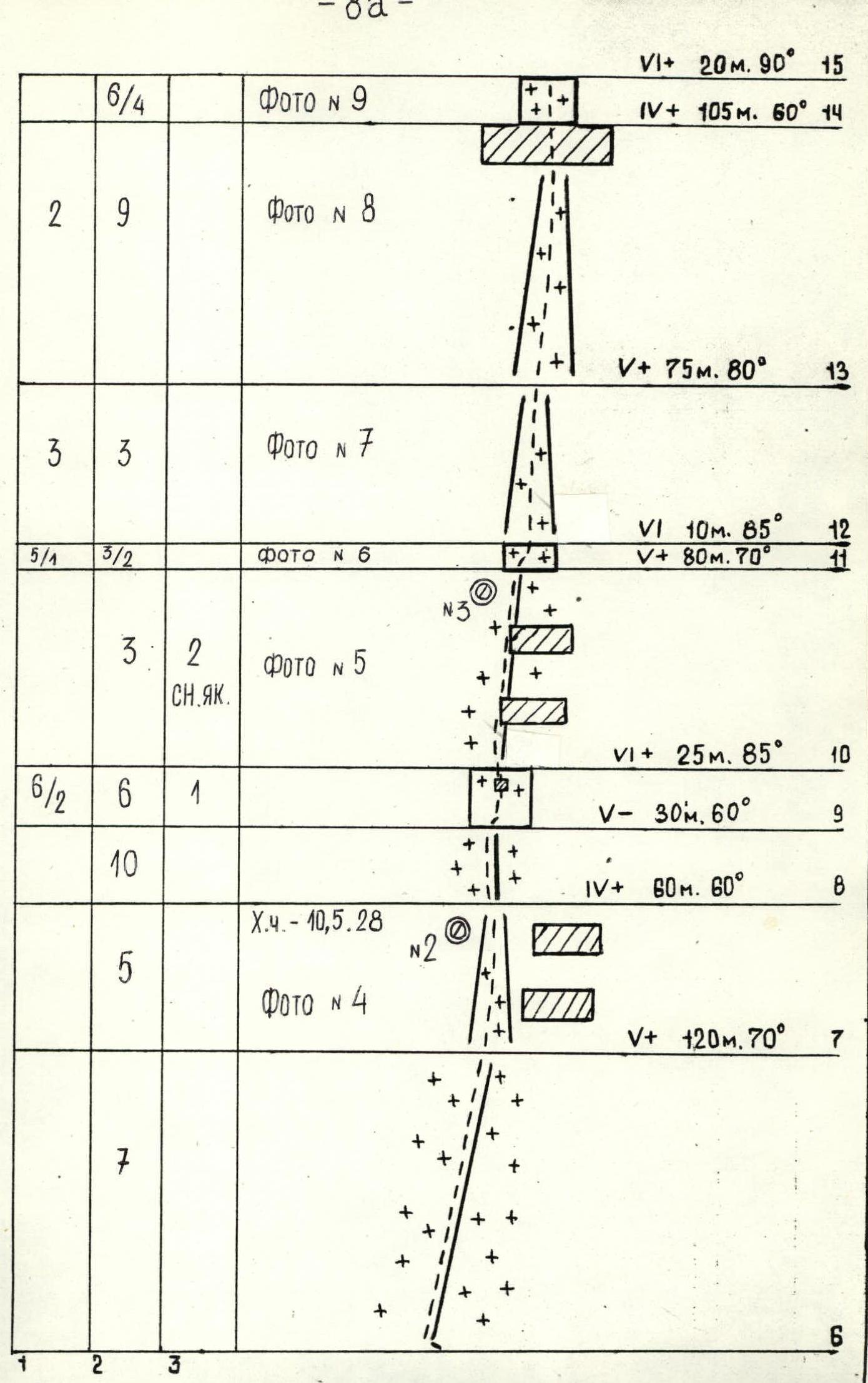
- Section R0-R1. The route begins from the bergschrund. A snow slope transitions into an ice-snow slope with a thin (5-10 cm) layer of snow. Rope teams move independently.
- Section R1-R2. Bypassing a rock outcrop on the right via ice, establishing belays.
- Section R2-R3. Ice ridge leading to a rock ridge, same as above.
- Section R3-R4. From the rock ridge, move left into an ice-snow gully. Up this gully for 120 m, then traverse right for 12 m, crossing an avalanche gully, followed by 50 m up the left side of a snow-ice ridge, and exit onto the ridge's watershed. Movement is alternating with belay establishment and so on for all sections except the "Dome". The first overnight is here, carved into the ice.
- Section R4-R5. From the overnight, move up the ice-snow ridge.
- Section R5-R6. Rock wall with flowstone.
- Section R6-R7. Up the ice-snow ridge to where it merges with a snow ridge on the right.
- Section R7-R8. Then, along an ice gully, bypassing a cornice on the left. Exit onto a ridge; the second overnight is here.
- Section R8-R9. Ice-snow ridge. The ice is porous, and ice screws hold poorly, requiring duplication.
- Section R9-R10. Rock-ice wall. In the lower part, there's a cleft in the rock. Pass through it. Then continue up the ice. The first climber uses a double rope. ITO (Intermediate Technical Obstacle). The slopes are heavily eroded; long wedge-shaped pitons work well.
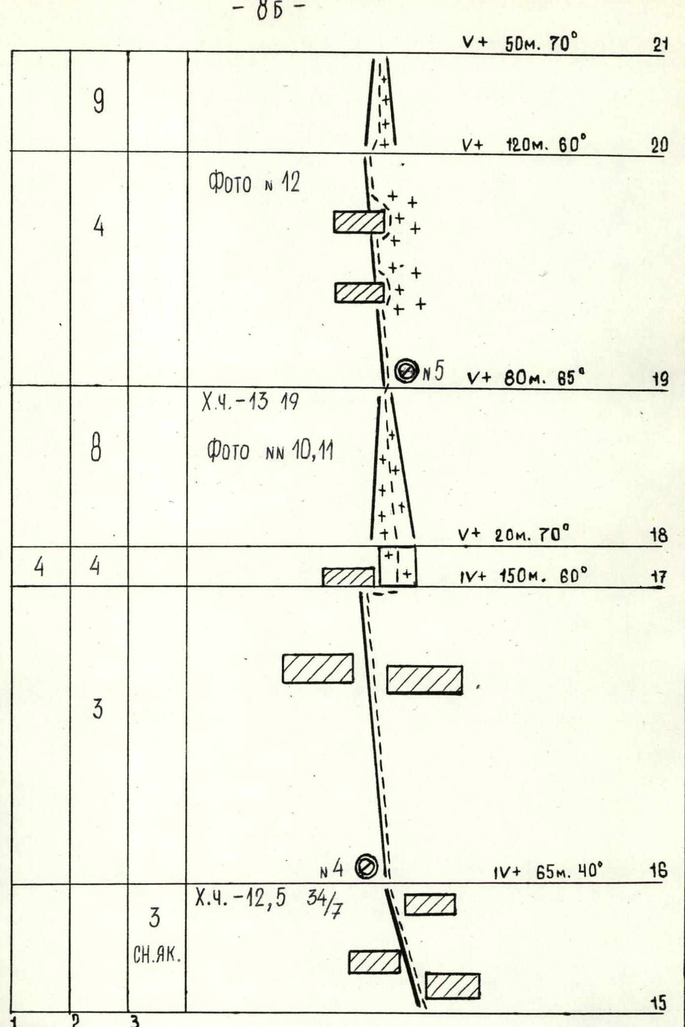
- Section R10-R11. Snow-ice ridge with cornices. The snow is fragile and unreliable. Belaying is done via ice axes and snow anchors. The ice is porous under a thick layer of snow. This snow structure characterizes the entire route. The third overnight is on a snow ridge under a snow wall.
- Section R11-R12. Up a wall with flowstone, exit right (ITO), and transition into a couloir.
- Section R12-R13. Rock-ice couloir. Exit into a wider rock-ice gully leading to the summit of a rock wall to the right of the route.
- Section R13-R14. Rock-ice gully. In its upper part, it ends with a large ice-snow cornice.
- Section R14-R15. Exit onto the cornice via the left wall using ITO. In the upper part, the snow cornice is traversed by cutting through it.
- Section R15-R16. Then along a snow ridge with cornices. After 50 m, the ridge widens. The snow is very unreliable. Belaying is done via ice axes and snow anchors. The fourth overnight is here.
- Section R16-R17. Continue up a steep corniced ridge to where it turns left towards a rock belt. Belaying is done via ice axes.
- Section R17-R18. After the ridge turns, bypass a snow cornice on the right via rock with flowstone.
- Section R18-R19. Up an ice-snow gully to exit onto a snow shoulder of the ridge. The fifth overnight is here.
- Section R19-R20. From the fifth overnight, move 100 m up a steep snow ridge with cornices. Two large cornices are bypassed on the right via firn. Belaying is done via ice axes.
- Section R20-R21. From the ridge, traverse right into an ice couloir. The ice is very hard and winter-like, breaking off in slabs. Move up the couloir to exit onto snow.
- Section R21-R24. Snow slope. The snow is very deep and loose. A trench must be dug. The snow slope leads to a rock wall, which consists of large blocks with almost no cracks, covered in flowstone and heavily snowed. From the start of the wall, traverse right for 3 m, then move up to approach the wall. The wall is ascended directly via a cleft.
- Section R24-R25. Then, transition right and up into a snow-ice couloir and up it to under an ice cornice. There's a grotto in the cornice where the sixth overnight is established.
- Section R25-R26. Exit onto the cornice with the "Sphinx" via ice on the left, then onto a ridge extending from the ice "Sphinx" to the summit dome.
- Section R26-R27. Snow ridge and cornices lead to an ice rift, which is an ice wall 40 to 80 m high. Belaying is via ice axes and snow anchors.
- Section R27-R28. The ice wall is ascended at its narrowest point from left to right. The first climber uses a double rope with pulling.
- Section R28-R29. A snow ridge transitioning into a slope leads to the summit. The snow is loose and deep (about 1.0 m). Movement is simultaneous. The seventh overnight is in a hollow below the summit.
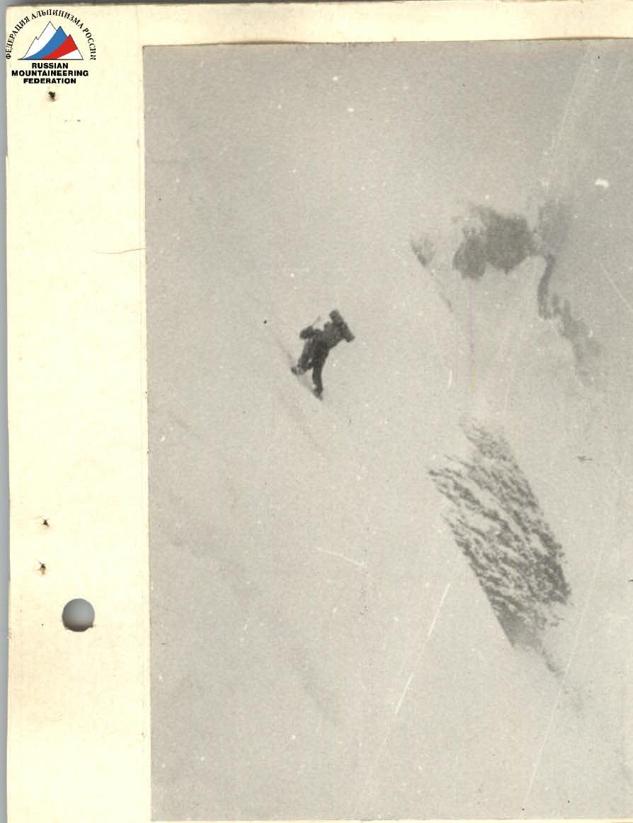
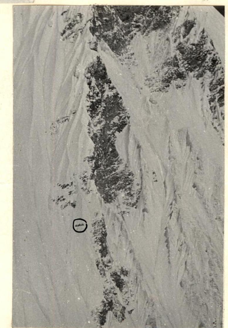
Photo 1. Section R3-R4. Traversing the gully. August 13, 1988, 16:00
Photo 2. Overnight #1. August 14, 1988, 10:00
TECHNICAL PHOTO OF THE SUMMIT. August 30, 1988, 16:00, "Canon" lens, F = 50 mm, distance - 1 km, from a helicopter H = 5800 m.
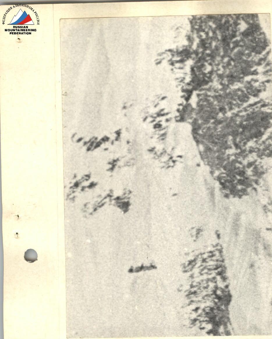
Photo 3. Overnight #1. August 14, 1988, 10:00
Photo 4. Overnight #2. August 16, 1988, 10:30
