Ascent Passport
-
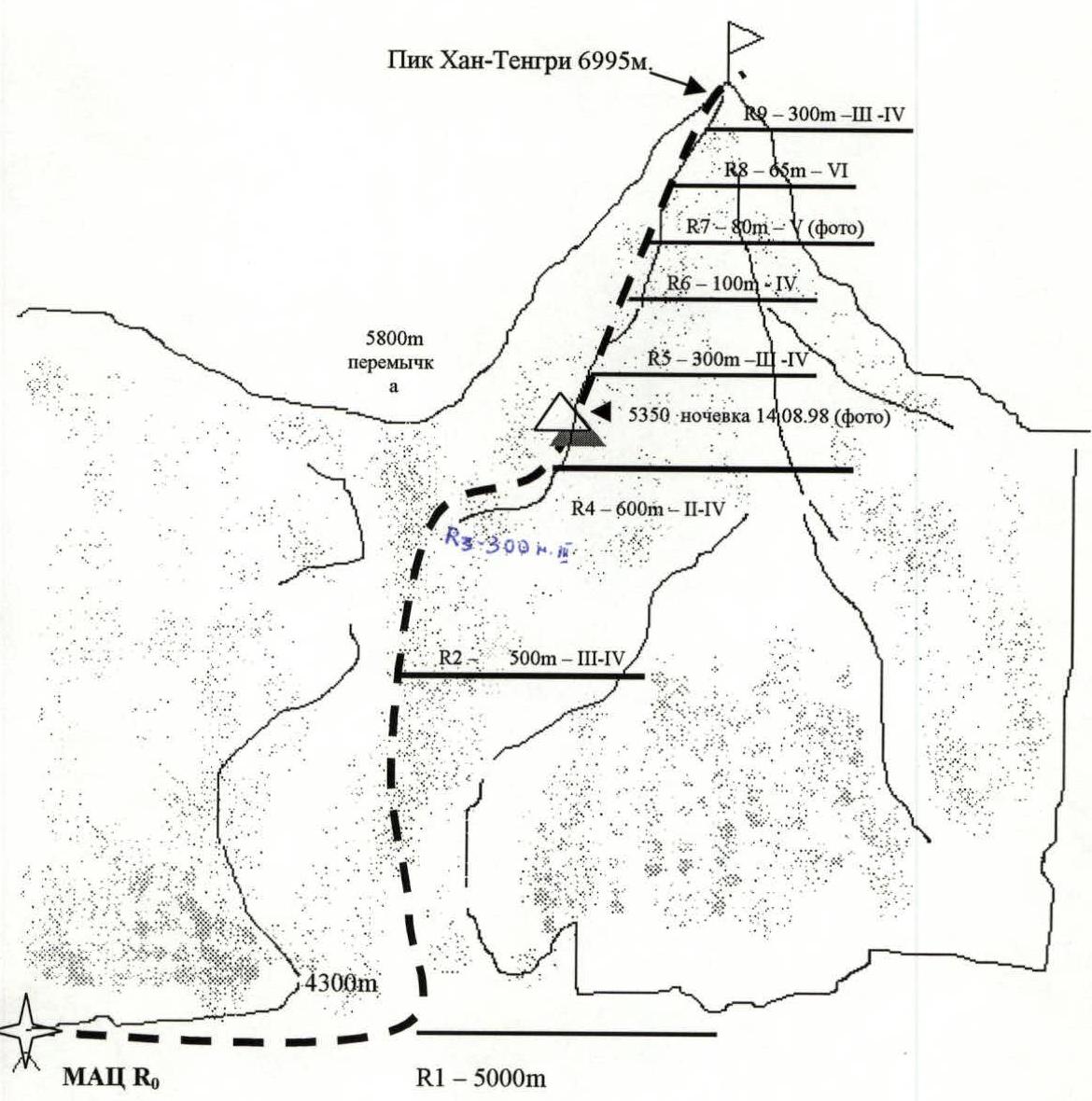
Ascent category: high-altitude and technical.
-
Ascent region: Central Tian Shan, South Inylchek.
-
Ascent route: Khan-Tengri peak via the Southwest slope, 4. M. Pogrebetsky 1931.
-
Category of difficulty: 5B
-
Route characteristics:
elevation gain: 2985 (by altimeter), ascent length: –9 km, descent length: –9.4 km, section lengths: 5th category of difficulty – 120 m, 6th category of difficulty – 65 m. average steepness: main part of the route – 38°, entire route (from bergschrund) – 30°
-
Pitons used:
| rock | chocks | ice screws | bolted pitons |
|---|---|---|---|
| 8 | 12 | 6 |
Left on the route: rock – 0, chocks – 0, ice – 0, bolted – 0
-
Team's travel time: 21 hours 20 minutes.
-
Overnight stay: in a tent at 5350.
-
Ascent participants:
Sergey Konstantinovich Penzov – MSMK, Severodvinsk, Lesnaya St. 52-2 Mikhail Vasilyevich Ishutin – MS, Severodvinsk, Lomonosov St. 59-9 Mikhail Grigoryevich Strelkov – CMS, Severodvinsk, Malaya Kudma St. 13-49
-
Team coach: Mikhail Vasilyevich Ishutin
-
Ascent calendar:
departure on the route: Khan-Tengri peak – August 14, 1998, summit – August 15, 1998 (15:15). Return to base camp – August 16, 1998 (10:20)
-
Issuing organization's address: "Sever" sports club, Severodvinsk, Lenin Ave. 14, "Gorsportkompleks"
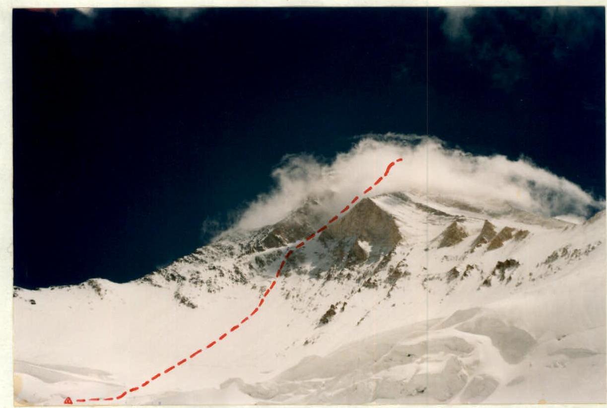
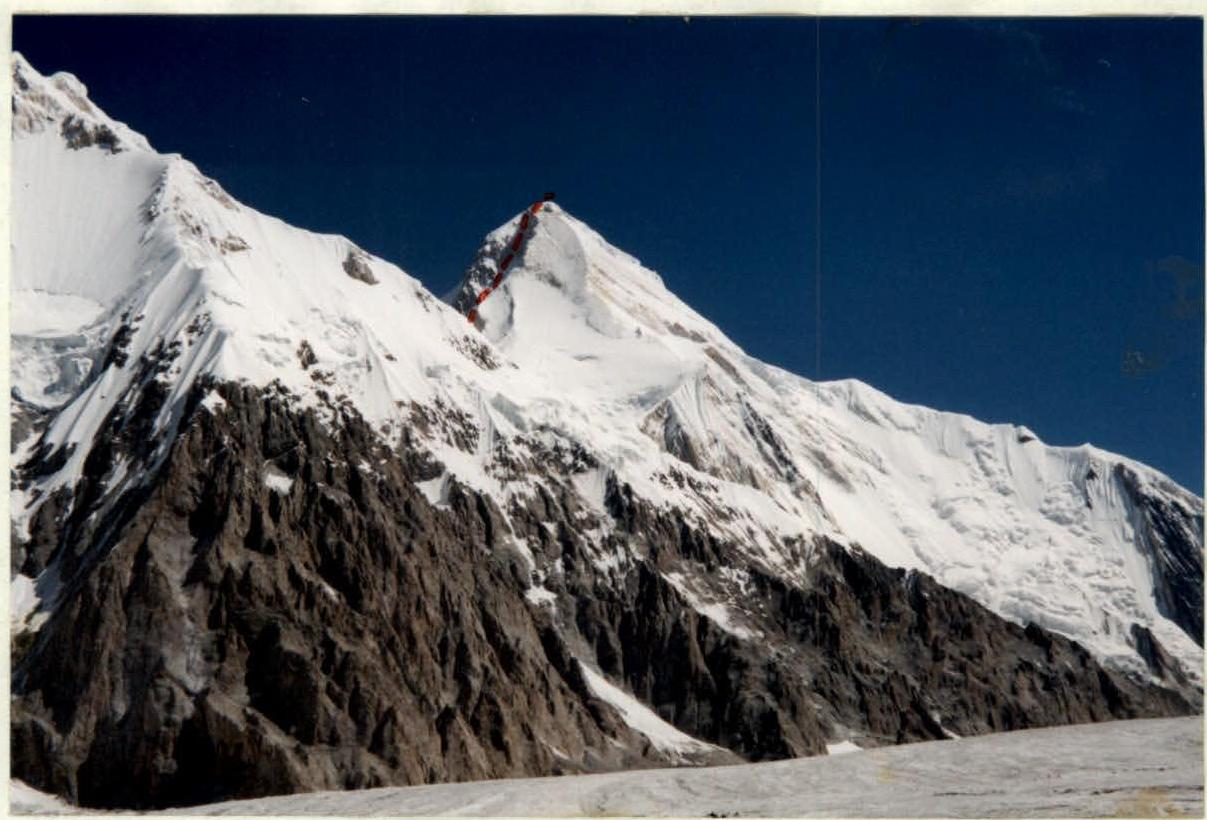 Khan-Tengri peak. View from South Inylchek glacier. Photo by M. Ishutin, July 26, 1998
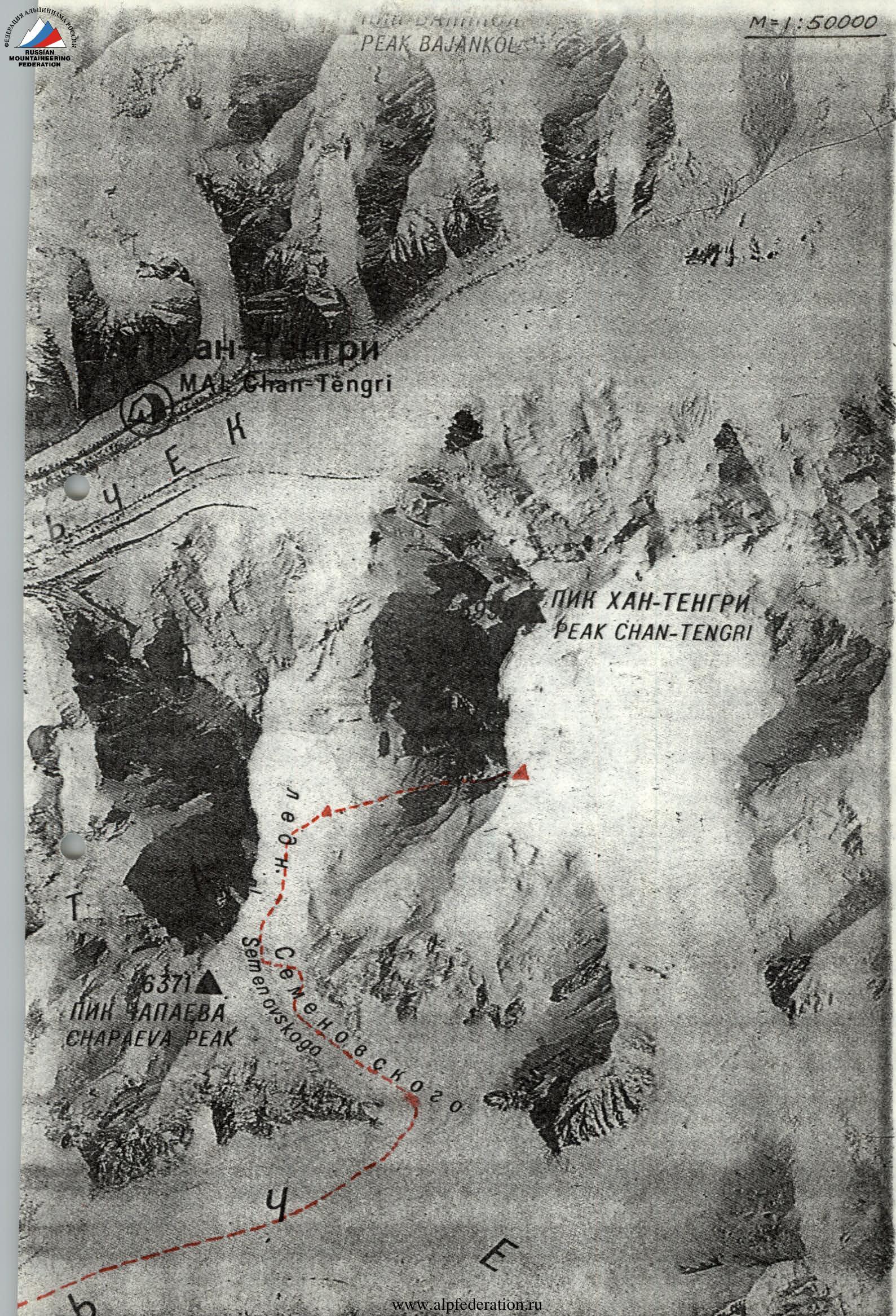
 Khan-Tengri peak. View from 5600 m, Semenovsky glacier. Photo by M. Ishutin.
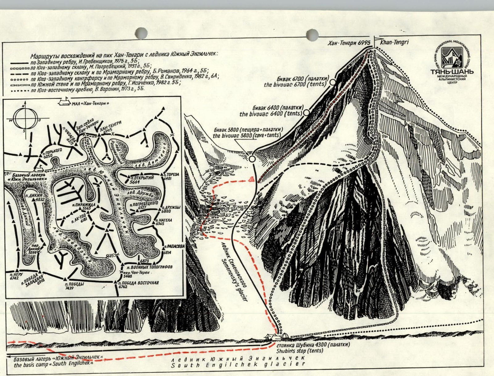
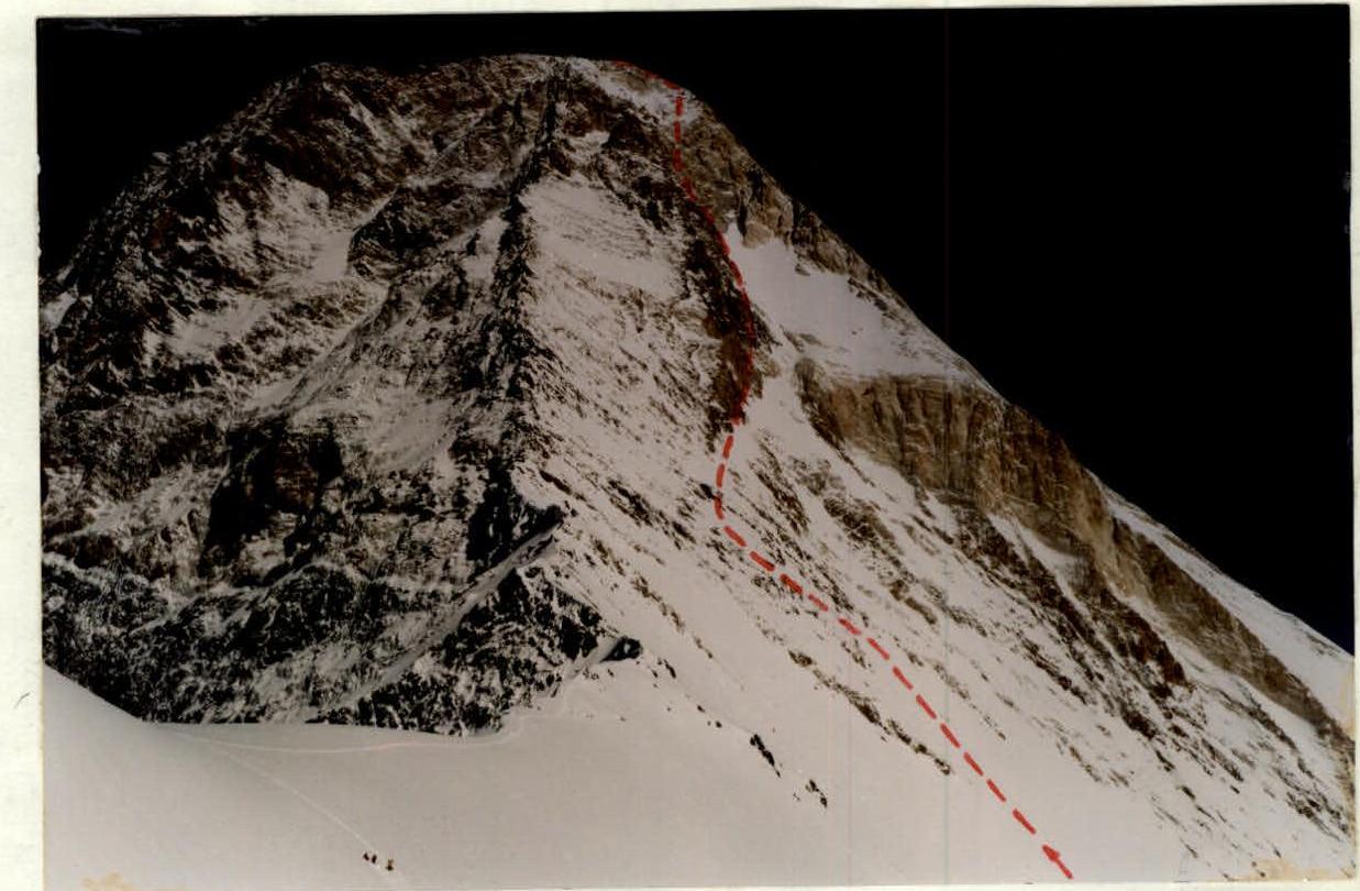
 Overnight stay below the bergschrund on August 14, 1998. Photo by M. Strelkov.
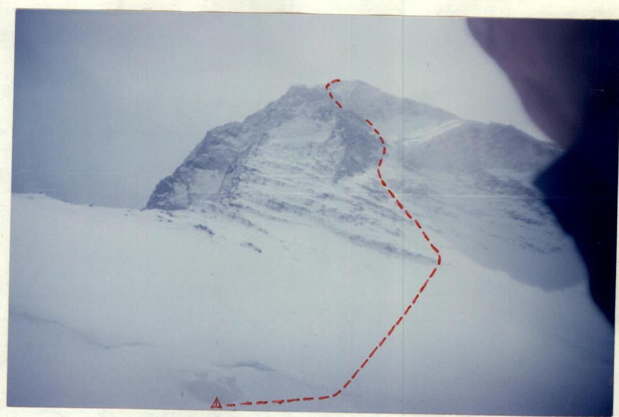 Visible part of the route from the camp at 5350 m. Photo by M. Strelkov.
Tactical Actions
-
On the route, the team worked as a single rope team. The snow on the route was very deep and loose. Rocks and protruding stones were covered with snow and ice. In the upper part, where the group's route joined the classic route, chockstones and rock pitons were used.
-
An early departure from the "Tian Shan" MAC base camp allowed the team to traverse to the ascent and climb to the 5350 overnight camp on a firm crust.
-
The team tried to traverse avalanche-prone sections before avalanches occurred, which were numerous this year due to heavy snowfalls.
-
The team stopped for the night at 13:30, which provided sufficient time to rest, inspect the visible part of the route, and prepare for the ascent.
-
Rescue team's location and actions:
The Chelyabinsk region team was located on a ridge (5800 m). Constant communication was maintained with the MAC base, where the rescue team was headed by the camp chief Kolovanich S.F. (communication at 7:00, 9:00, 13:00, 17:00, 20:00).
-
Descent was made via the "classic" route.
-
To avoid being hit by rocks from Chapayev peak (this year the route across Semenovsky glacier passed near the rocks due to the glacier's break-up) and avalanches, the team decided to stop for the night at 17:00 and descend to the camp safely early in the morning.
Route Diagram in Symbols