Ascent Passport
- Ascent class — combined
- Ascent area — Tian-Shan, Kungay Alatau ridge
- Peak — Drakon, height — 3880 m, route — via Western ridge, combined
- Estimated difficulty category — 4A
- Route characteristics: – height difference — 370 m – average steepness — 40° – length of 5th category sections — 14 m
- Pitons hammered: – for belay — 18, for creating I.T.O. — 2 – rock pitons — 18
- Overnights on the route — none
- Total climbing hours — 8 hours
- Group composition: – Ganyalin V.A. — Candidate for Master of Sports, leader – Budylko D.I. — 1st sports category, participant – Zabara B.M. — 1st sports category – Litvinov A.V. — 1st sports category
- Team coach — Ganyalin B.A.
- Date of departure on the route and ascent — July 19, 1981
TABLE OF MAIN CHARACTERISTICS OF THE ASCENT ROUTE
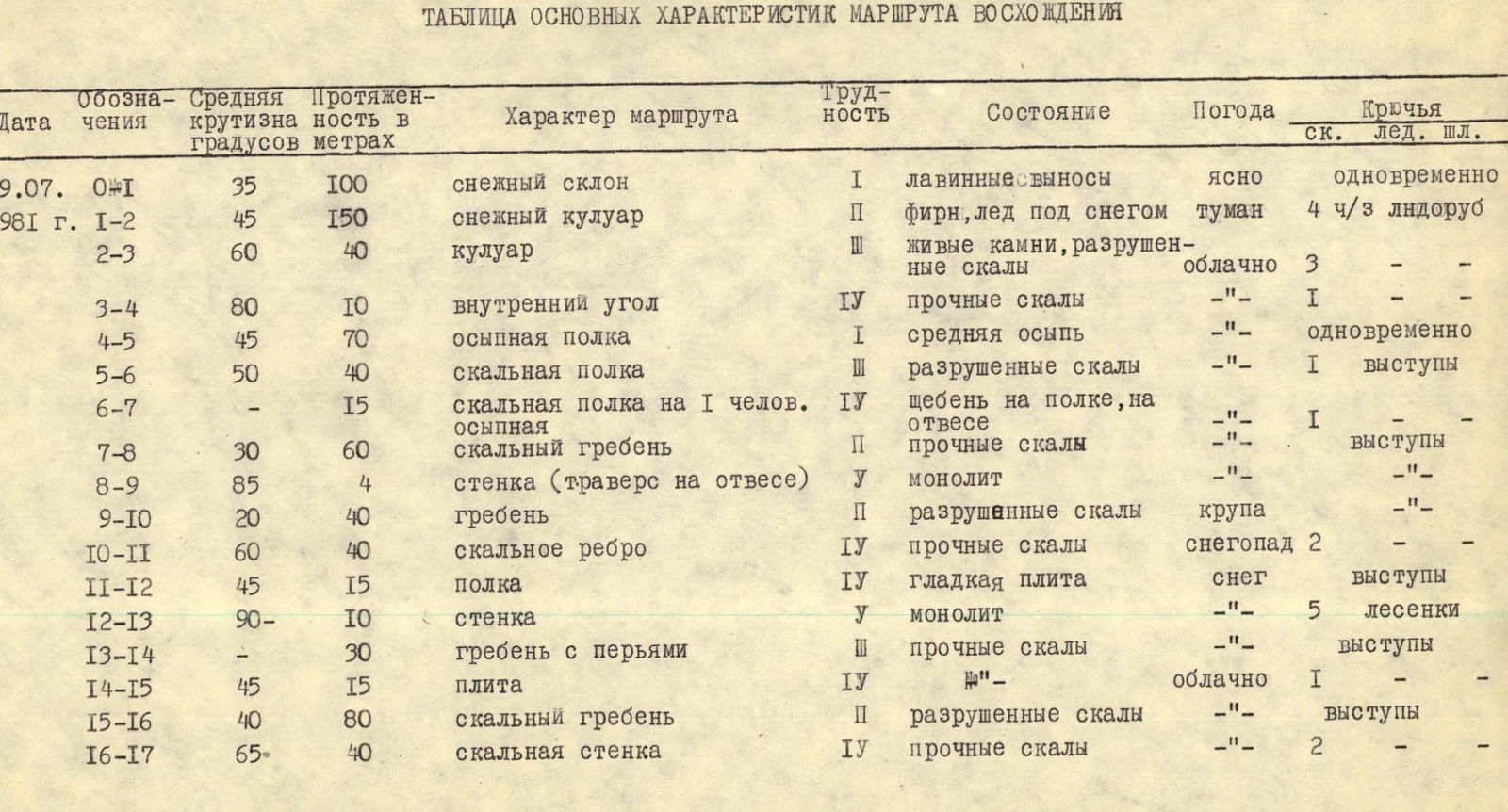
| Date | Designation | Average steepness in degrees | Length in meters | Route character | Difficulty | Condition | Weather | Rock pitons | Ice pitons and ladders |
|---|---|---|---|---|---|---|---|---|---|
| 19.07. | 0–1 | 35 | 100 | snow slope | 1 | avalanche deposits | clear | simultaneously | |
| 1981 | 1–2 | 45 | 150 | snow couloir | 2 | firn, ice under snow | fog | 4 pcs | ice axe |
| 2–3 | 60 | 40 | couloir | 3 | loose rocks, broken rocks | cloudy | 3 | – | |
| 3–4 | 80 | 10 | inner corner | 4 | solid rocks | —" | 1 | – | |
| 4–5 | 45 | 70 | scree ledge | 1 | medium scree | —" | simultaneously | ||
| 5–6 | 50 | 40 | rocky ledge | 3 | broken rocks | —" | 1 | rock outcrops | |
| 6–7 | – | 15 | rocky ledge for 1 person, scree | 4 | rubble on ledge, on sheer | —" | 1 | – | |
| 7–8 | 30 | 60 | rocky ridge | 2 | solid rocks | —" | rock outcrops | ||
| 8–9 | 85 | 4 | wall (traverse on sheer) | 5 | monolith | —" | – | ||
| 9–10 | 20 | 40 | ridge | 2 | broken rocks | graupel | —" | – | |
| 10–11 | 60 | 40 | rocky edge | 4 | solid rocks | snowfall | 2 | – | |
| 11–12 | 45 | 15 | ledge | 4 | smooth slab | snow | rock outcrops | ||
| 12–13 | 90– | 10 | wall | 5 | monolith | —" | 5 | ladders | |
| 13–14 | – | 30 | ridge with pinnacles | 3 | solid rocks | —" | rock outcrops | ||
| 14–15 | 45 | 15 | slab | 4 | —" | cloudy | 1 | – | |
| 15–16 | 40 | 80 | rocky ridge | 2 | broken rocks | —" | rock outcrops | ||
| 16–17 | 65 | 40 | rocky wall | 4 | solid rocks | —" | 2 | – |
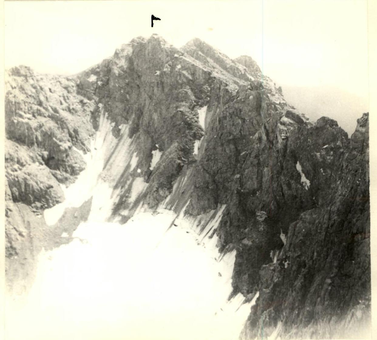
Middle and upper part of Drakon's Western ridge
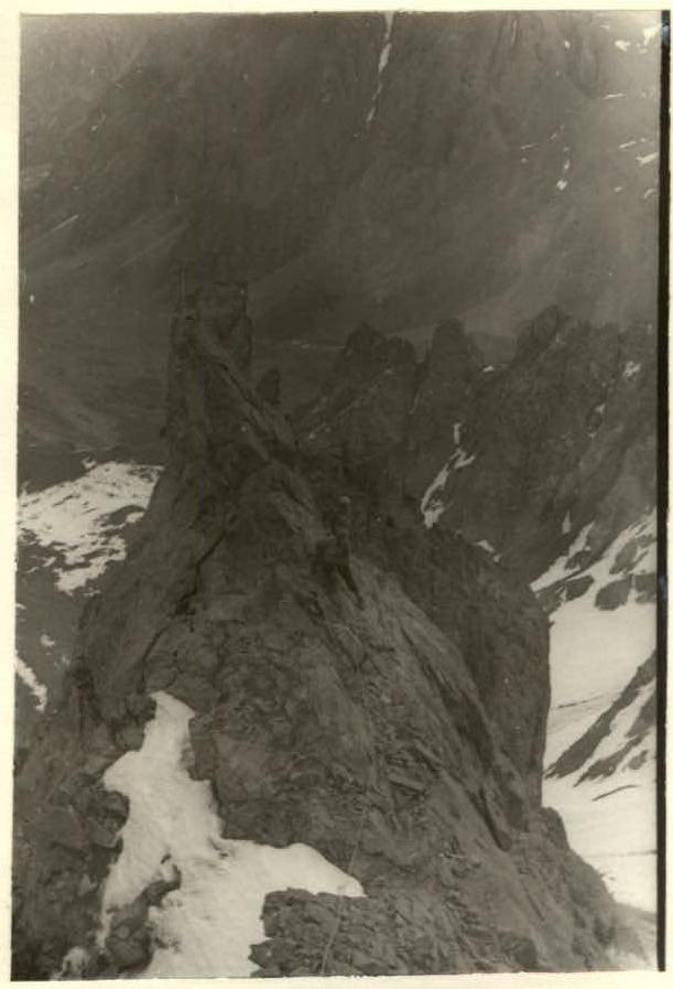
section 5–6
