Ascent Passport
I. Ascent class 2. Ascent area 3. Summit 4. Estimated difficulty category 5. Route characteristics:
- elevation gain
- length of sections with 1st difficulty category
- length of sections with 2nd difficulty category
- route type
- Pitons hammered:
- for creating belays
- rock pitons
- ice pitons
- bolt pitons
- Number of walking hours
- Ascent participants:
- Gavrilov A.P., CMS
- Dzarahohov A.B., CMS
- Majdanjuk V.I., 1st sports category
- Galushkin A.G., 2nd sports category
- Team coach: Gavrilov A.P.
- Date of departure on the route
- Organization
-
rock
-
Trans-Ili Alatau ridge
-
Bogdan Khmelnitsky, 4150 m, North ridge
-
1B
-
350 m
-
477 m
-
100 m
-
combined
-
none
-
3 pcs.
-
none
-
none
-
5 hours
-
leader
-
participant
-
participant
-
participant
-
June 2, 1984
-
Kaz. RS "Dynamo"
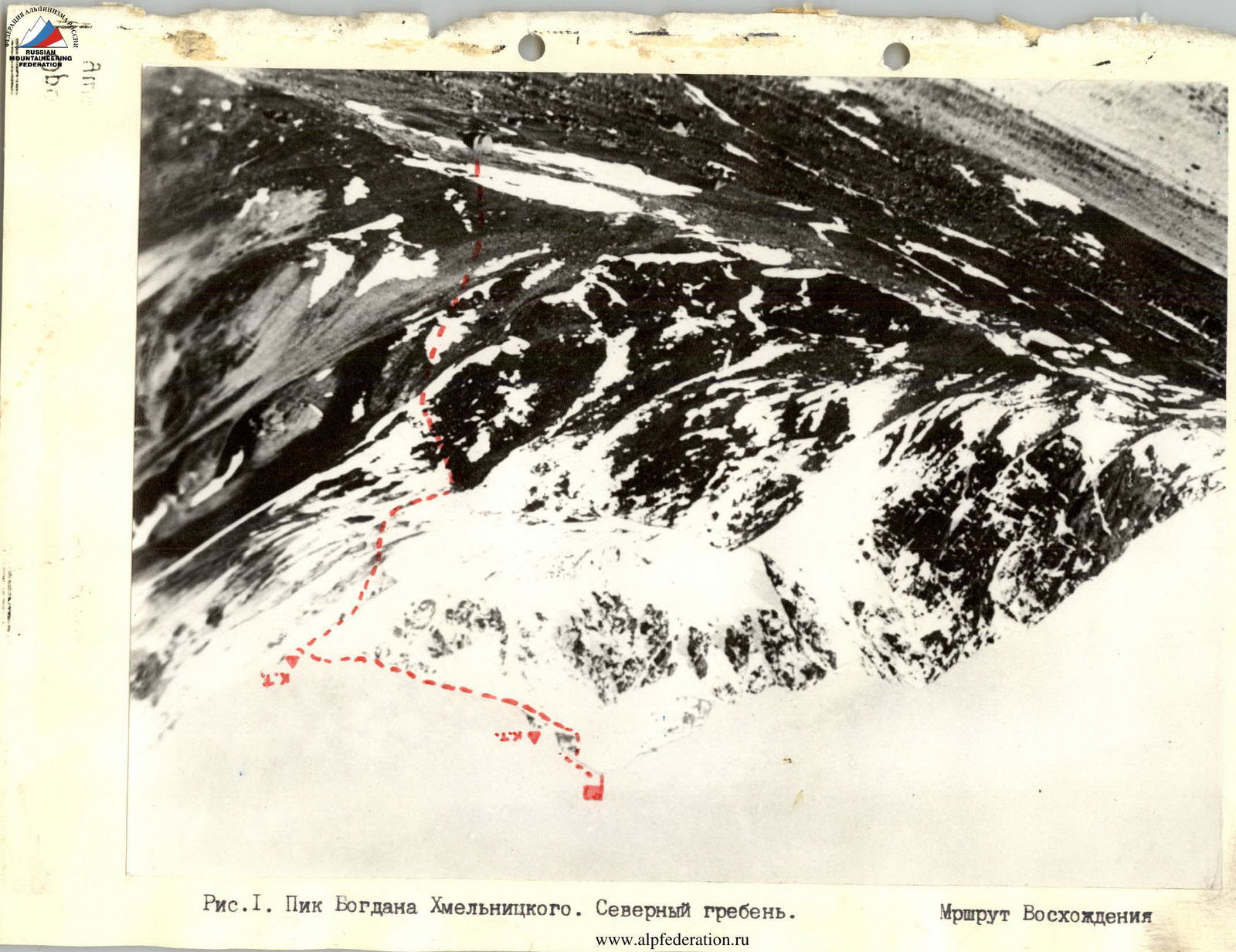
Fig. 1. Peak Bogdan Khmelnitsky. North ridge.
Fig. 2. Orographic scheme of the Aksay river gorge.
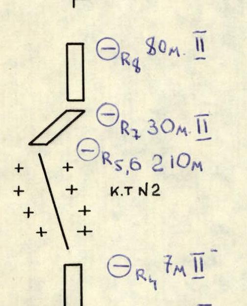
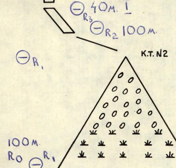
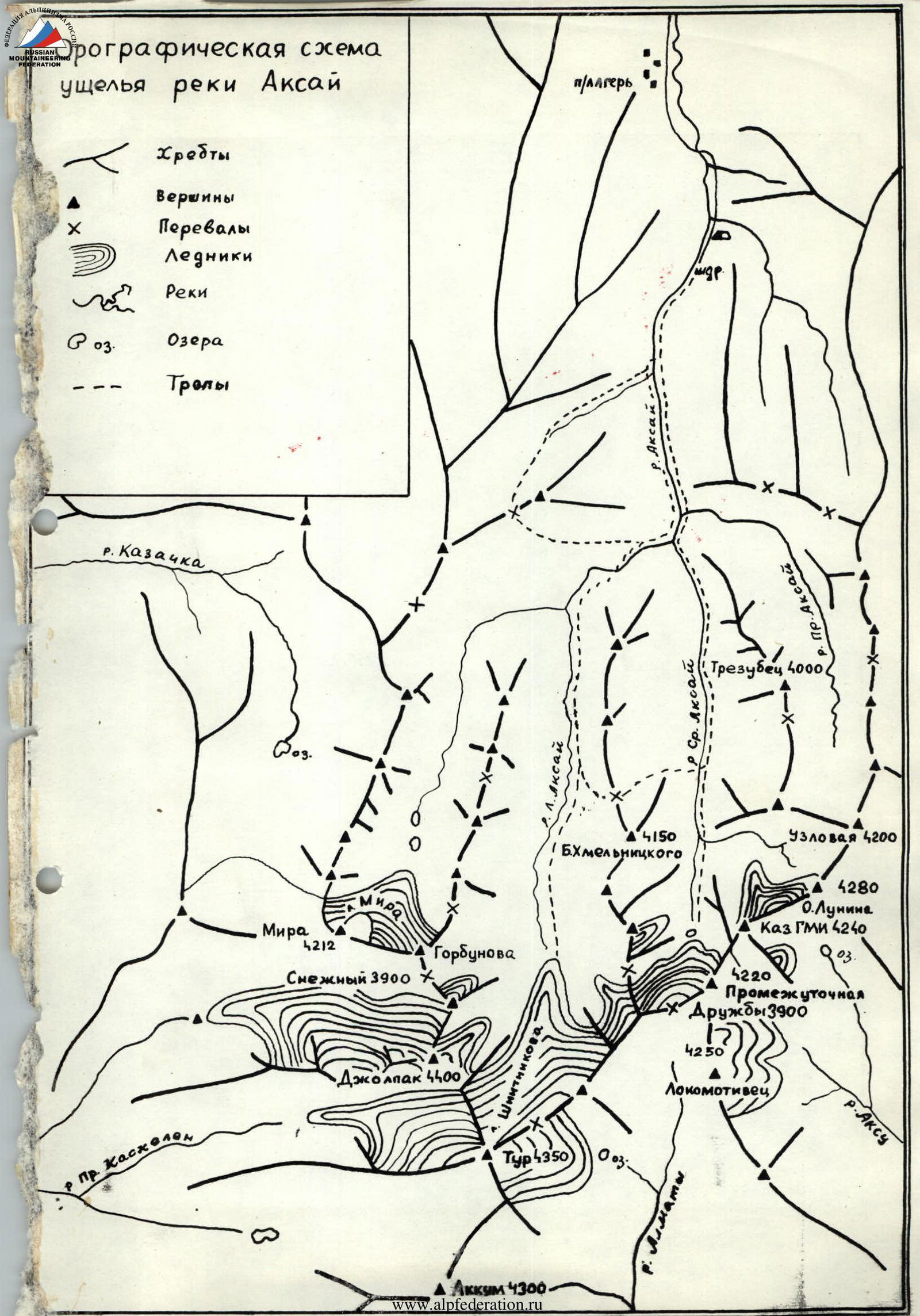 Fig. 3. Route scheme in symbols.
From the city of Alma-Ata, take a highway road by car to the "Leninets" pioneer camp. Then, on the right (orographically) side of the gorge, walk to the confluence of three rivers: Levyy, Sredniy, and Pravyy Aksay — 4 hours walking from the pioneer camp.
The further path lies along the valley of the Sredniy Aksay river, on the right (orographically) side, leading to a large rock fragment ("big stone") lying in the river floodplain — 2 hours walking from the confluence of the rivers. Here is the initial bivouac.
In the morning, cross to the left bank of the Sredniy Aksay river and move along the steep ancient moraine in a western direction, towards the pass, north of Peak B. Khmelnitsky. At the pass is the start of the route — 3 hours walking from the "big stone". Here is a control cairn.
Route description along the North ridge to peak B. Khmelnitsky: R1. Ascent along grassy and scree slopes to the pass col. Control cairn. 200 m, 35°. R2. From the control cairn, south along the ridge, 60 m on simple rocks to two "gendarmeries" 100 m, 35°. R3. Two "gendarmeries" are bypassed on the right along ledges 40 m, 35°. 1st difficulty category. R4. The third "gendarmerie" is overcome "head-on" on rocks of 2nd difficulty category, 7 m, 45°. Belay through a piton. R5. Scree ridge with a steepness of 25°, 80 m leads to a horizontal section of the ridge 60 m. Control cairn. R6. Snow ridge 70 m, 40°. Exit to the forepeak. R7. Descent to the col between the summit and the forepeak. Rocks of 2nd difficulty category, 50°, 30 m. Belay through ledges and a piton. R8. Ascent to the summit on rocks of 2nd difficulty category, 80 m, 50°. Belay through ledges and a piton. R9. Descent along the ascent path.