First Ascent to the Western Peak "Bezbozhnik" via the North Face
The peak "Bezbozhnik" is located in the Dmitriyevka spur, which branches off from Stal'skiy peak and separates the Stal'skiy Glacier to the north and the Frunze Glacier to the south; both glaciers feed the tributaries of the Leviy Talgar River. To the east, "Bezbozhnik" peak is separated from Frunze peak by a pass of the same name, and to the west, a rocky-snowy ridge connects "Bezbozhnik" peak to an unnamed peak.
The Leviy Talgar valley is rarely visited by climbers from both "Talgar" and "Tuyuk-Su" alpine camps (due to the non-classification of peaks and remoteness).
At the beginning of the summer season in 1962, a group of instructors consisting of Mansurov B.Sh. and Postnikov V.V. conducted a reconnaissance in the Leviy Talgar area. They took photographs, compiled piton records, and descriptions of many peaks. The reconnaissance aimed to find routes of 5B category difficulty. Three routes were discovered:
- to the peak Konstitutsiya via the wall,
- to an unnamed peak in the area of the Dmitriyevka lesgik,
- to the "Bezbozhnik" peak.
There was one existing route to "Bezbozhnik" peak with a category of 4B-5B.
A group of instructors consisting of:
- Mansurov B.Sh.
- Postnikov V.V.
- Rozhkov V.V.
- doctor of the alpine camp, climber Vakulyn V.K.
completed an ascent via this route on June 29, 1962, to familiarize themselves with the peak and scout a new route.
Day I
The group, comprising:
- Mansurov B.Sh. — 1st sports category
- Postnikov V.V. — 1st sports category
- Rozhkov V.V. — 2nd sports category
- Vakulyn V.K. — 2nd sports category
departed from the "Tuyuk-Su" alpine camp into the Leviy Talgar valley. The path to the Leviy Talgar valley passes through the Talgarskiy pass and then the Malo-Talgarskiy pass. Descending from the pass, they entered the valley. Following the trail alongside the river, they arrived at the abandoned "Alpyskaya Rosa" camp. The time taken to reach "Alpyskaya Rosa" was 6-7 walking hours. They spent the night at "Alpyskaya Rosa".
Day II
Leaving the abandoned camp and crossing the Leviy Talgar River on a log (the only crossing in the area), they proceeded downstream. 150-200 meters from the crossing, a stream flows into the Leviy Talgar River, along which a trail leads to the Stal'skiy Glacier and the TEU pass.
Moving along the stream:
- initially on the left (orographic) bank,
- then crossing to the right bank,
the group entered a valley filled with the terminal moraine of the Stal'skiy Glacier. Ascending the right (orographic) bank of the moraine into the depths of the valley, they approached the north face of "Bezbozhnik" peak.
The approach from the abandoned camp took 4-5 hours.
After setting up camp, the group spent the rest of the day observing the wall.
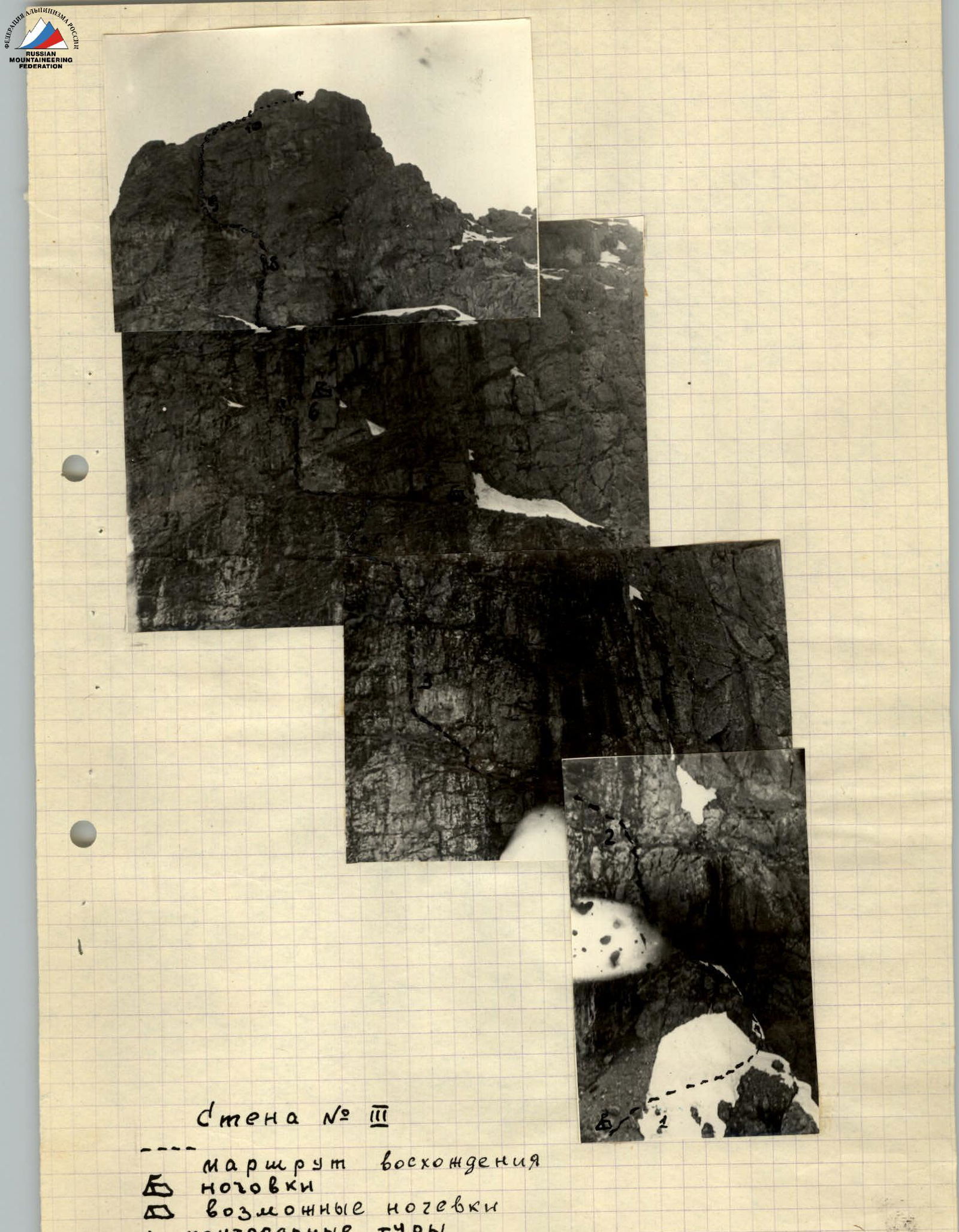
The north face is divided into two parts by an ice cliff — the eastern and western sections.
The eastern peak drops northward with an 800-meter wall featuring inclined ledges covered in snow, from which rocks and ice fragments constantly fall. This wall is under constant "fire" and is not recommended for ascents.
The object of the ascent was the western peak, from which the north face drops with a wall that can be divided into three sections.
List of wall sections:
- 1st section, 300 meters long, with an average steepness of 75° to 30°
- 2nd section, 250 meters long, 70-80° with a 90-meter drop into a depression.
1st section, 300 meters long, with an average steepness of 75° to 30°
2nd section, 250 meters long, 70-80° with a 90-meter drop into a depression.
3rd section, 400 meters, with a steepness of 70-85°.
Day III
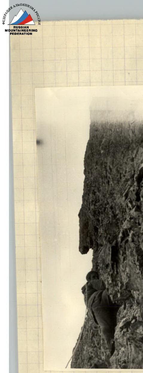
Leaving the bivouac under the wall at 4:00, the group began moving in rope teams. The path up the first wall (first section) immediately starts with difficult rock climbing. A 70-meter wall is overcome directly, with a steepness of about 70-75°. The rocks are smooth, but there are holds. 14 pitons were hammered in. Further, they ascend along an inclined ledge (or "board") with a steepness of 50° and a length of 15-20 meters — reaching a platform and traversing right (by the route) across a chimney, which is dangerous due to falling rocks. Next is a 15-meter section. The wall is overcome with careful piton protection (6 pitons), leading to two step-like platforms adjacent to the next 60-meter wall with a steepness of 40-60°. The rocks are monolithic with good holds and ledges. 8 pitons were hammered in on this section. Further, the wall becomes less steep, and an easy section follows until wall R2. The second wall — 80 meters of difficult climbing, monolithic rocks, 80° steepness, with careful protection. They traverse right onto a ledge and reach a ridge 100 meters long, with a steepness of up to 70°. Organizing careful piton protection, they reach the top of the second wall. 20 pitons were hammered in, a cairn was built, and a note was left. From the "summit" of the second wall, they rappel 60 meters onto a ledge, traverse right (along the ledge), and rappel again — 30 meters into a depression. The time taken to overcome the I and II walls and descend to the bivouac in the depression was 13 hours.
In the depression, a cairn was built, a platform for the tent was prepared, and there was snow.
Day IV
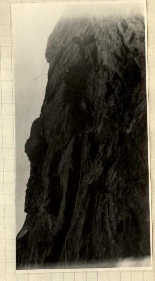
The third wall is the "key" to the ascent — an almost sheer cliff 400-450 meters long.
Dividing their gear into three backpacks, as the first climber goes without a backpack, the group started the штурм of the most complex section at 7:00 AM. Mansurov B. led, carefully examining the upcoming path, and slowly began to ascend. The path, after a small snowfield, goes along a narrow ledge covered in snow, which goes up to the left.
They approached a 40-meter sheer cliff. The rocks are completely smooth (section R1-R2) and wet; the only hope is a crack winding upwards. The first piton is hammered in, followed by the second, third, etc. They overcome this section using ladders. Further, the path goes left (by the route) along a ledge 5-10 meters long — with piton protection — and again a wall. 25 rock pitons were hammered in on the R1-R2 section.
Next is a short, 10-meter sheer cliff with few holds and wet rocks. Movement is aided by ladders. Along a minor ledge, they traverse left, 50 meters, with piton protection. Again, they approach the wall: first, it goes up to the left along small ledges, and then straight up.
The rocks are difficult; they ascend 30 meters to a small platform. 17 pitons were hammered in on the R2-R3 section.
The R3-R4 section is one of the most challenging on this wall. Rozhkov leads. There are no natural means for protection here; a simpler path does not exist; the wall is sheer. The only possibility for ascent is directly "head-on". Carefully examining the 35-meter wall, Rozhkov hammers in a piton and begins the ascent. The second piton is a meter higher. From the slow movement of the rope, they infer that Volodya is moving forward.
Reaching the ledge before section R4, he securely anchors the rope and receives his companions and backpacks. 15 pitons were hammered in on this section.
Before section R4, a note is left in a can nailed to the wall.
Section R4-R5 is a wall with a steepness of 70-75° and a length of 20-25 meters. The path goes left and up along difficult rocks, then right along a crack, which leads to a good ledge. After traversing 10 meters to the right, they reach a niche suitable for an overnight stay. There is no path to the right of the niche. Returning to the starting point, they continue traversing along a narrowing ledge to the left for about 20 meters. They come under a wall — monolithic rocks. They have to use artificial points of support. Expanding pitons and ladders are used. The section is technically complex. Most importantly, on this path, there is an exit to ledges R6 and R7. The time taken to pass section R5-R6-R7 was 4 hours. Ledge R7 is large but very sloping. The group decided to descend for the night to the smaller but more comfortable ledge R6.
Working on the wall for 14 hours this day, the group covered approximately 350 meters. A note was left at the overnight spot, and a cairn was built.
Day V
Rising at 5:00 AM, as the weather began to deteriorate, one rope team dismantled the bivouac while the other, quickly ascending to ledge R7 using the left-behind fixed ropes, approached wall R8. The wall forms an internal angle; the first 8 meters are climbed using ladders, and then by simple climbing. Its length is 30 meters, leading to a short projection. Then, they traverse left along very smooth and steep rocks. Then, again, an internal angle up to the shoulder of the western peak, which is climbed with piton protection.
200 meters to the third peak — the path is straightforward along easy rocks with a steepness of 30-40°.
The group reached the summit at 12:00. After building a cairn and visiting the eastern peak (an elementary path), the group descended to the south and reached the "Alpyskaya Rosa" area by 19:00.
Day VI
After spending the night in the abandoned camp, the group returned to the "Tuyuk-Su" alpine camp via the same route.
Route Recommendations
The ascent to the Western peak "Bezbozhnik" via the north face through the depression is recommended for a group of four. The group should have good coordination and prior experience with several wall ascents of 4B-5B category difficulty, as overcoming the north face requires high rock climbing technique and good teamwork. It is mandatory to have pitons and expanding pitons.
The group was equipped with the following gear:
- Main rope — 40 m × 2
- Auxiliary rope — 50 m
- Hammers — 2 pcs.
- Ice axes — 2 pcs.
- Rock pitons — 35 pcs.
- Carabiners — 12 pcs.
- Pitons — 2 pcs.
- Expanding pitons — 15 pcs.
- Tent — 1 pc.
- Down sleeping bags — 2 pcs.
- Down suits — 4 pcs.
- Crampons — 2 pairs
- Ice pitons — 4 pcs.
- Primuses — 2 pcs.
Comparing the difficulty of the route taken with other wall routes of 5A and 5B category difficulty:
- Kara-Tau — 5A
- Svobodnaya Koreya via the wall — 5B
- Svobodnaya Koreya via the NW wall — 5A
- Talgar 3rd wall — 5B
- Ullu-Tau-Sana — 5B
the group believes that the path to the Western peak "Bezbozhnik" via the north face is technically not inferior to the listed routes and can be classified as a 5A category route, although it may deserve a much higher classification.
The description was compiled on September 25, 1962. Vakulyn V.K. Postnikov V.V.
 Section #5-6.
 Platform and overnight stay, section #6.
 see right MS.