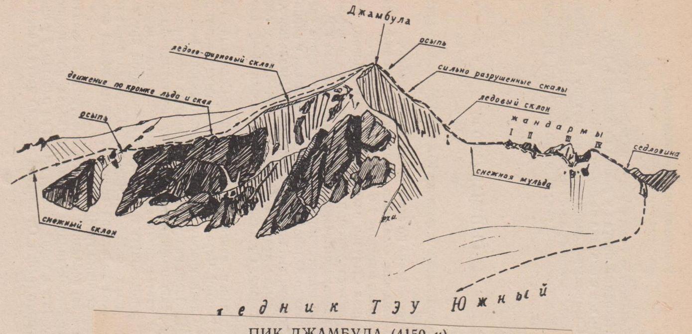
Peak Jambula (4150 m)
Ascent to peak Jambula with ascent from the northwest, route 2B cat. sl. (fig. 14).
From the bivouac at the lake under the tongue of the North TEU glacier, move to the South TEU glacier, bypassing the ridge coming from the Syputchaya peak. Ascend to the col between the peaks TEU and Jambula via the South TEU glacier. Move along the glacier in teams along the median moraine. Bypass the crevasse zone from the left. The ascent to the col is via a snowy slope with a steepness of 30–35°, then via scree and heavily destroyed rocks.
From the col, go along the snowy ridge to the 1st gendarme, which is taken head-on. Descent to the 2nd gendarme is via heavily destroyed rocks and snow. The 2nd gendarme is bypassed from the left along a slope with a steepness of 60°. Careful belaying through an ice axe is necessary. The 3rd gendarme is also bypassed from the left along a snowy-icy slope, closer to the rocks. Here, piton belaying is necessary (2–3 pitons), sometimes step chiseling. The 4th gendarme is bypassed from the left along a snowy slope with a steepness of up to 30°. Here, alternate belaying through an ice axe is necessary.
The route continues along an icy slope with a steepness of up to 40°, then via destroyed rocks and scree reaches the summit. From the bivouac to the summit is 5–6 hours of walking. The summit consists of two elevations. The cairn is on the northwestern one.
Descent is along the northeastern ridge to the South TEU glacier along a slope with a steepness of up to 45° with protruding large stones. Careful belaying is necessary. "Sheep's foreheads" are bypassed from the right. Go carefully: it is necessary to take into account the avalanche danger. The descent to the South TEU glacier goes along a snowy slope and takes about 2 hours.