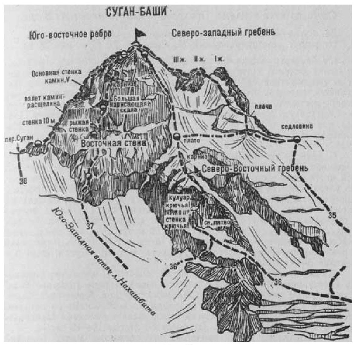
Fig. 9
- Suganbashi via the Northwest Ridge (a combined route by A. Zyuzin, category 3B difficulty, Fig. 9).
From the base camp on the right bank of the Psygansu River, near the tongue of the Nakhashbita Glacier (group of 4-8 people), ascend along the moraine ridge up the gorge. Then move right onto the Nakhashbita Glacier, cross it diagonally to the right and upwards, and approach the Western branch of the glacier descending from the Sugan Ridge saddle (between the Suganbashi peak on the left and the Central Sugan massif on the right).
From here, along the broken snowy slopes on the right side of the Western branch of the glacier, staying close to the slopes of the Eastern ridge of the Central Sugan massif (on the left, from the slopes of the Northeast ridge of Suganbashi peak hang ice seracs and the glacier is heavily broken), ascend to a small snowy plateau on the Sugan Ridge between Suganbashi and Central Sugan. Here, on the scree of the ridge, is the initial bivouac.
- From the base camp — 8-10 hours
- From the "Nakhashbita" clearing — 2 days
The path from the "Nakhashbita" clearing to the Nakhashbita Glacier is described in routes 17, 26, 22, 28.
From the initial bivouac:
- Turn left
- Along a gentle snowy slope, approach the bergschrund and overcome it via a snowy ridge
- Ascend 30-40 m to a small snowy shoulder on the Northwest ridge of Suganbashi peak
- Along the shoulder, approach an ice crevasse and, overcoming it, ascend a steep ice-snow slope 100-120 m straight up
- Bypass a large snowy cornice on the left with a traverse
- Ascend to the Northwest ridge to the left of the first rocky gendarme on the summit ridge
Here, turn left, along a steep 30-40-meter snowy ascent on the ridge, approach the second gendarme and overcome it directly via an 8-meter wall of moderate difficulty (piton protection). From the gendarme, descend onto the ridge via a slab, then along a heavily destroyed, snow-covered 30-40-meter ridge, bypassing small walls, approach the third gendarme, traverse it on the left for 10-12 m along a gentle snowy slope, and approach the summit ascent.
From here, directly upwards, along heavily destroyed, steep, moderate difficulty rocks on a 15-20-meter wall (pitons), then along a steep 40-meter snowy slope (protection). Further, along a gentle snowy ridge (cornices), ascend 20 m to the summit of Suganbashi. From the initial bivouac, 6-8 hours.
Descent follows the ascent route.
Duration of the route: 3 days.
Source: Naumov A.F. Karaugom, Digoria, Tsey (Central Caucasus), M., "Fizkultura i sport", 1976.