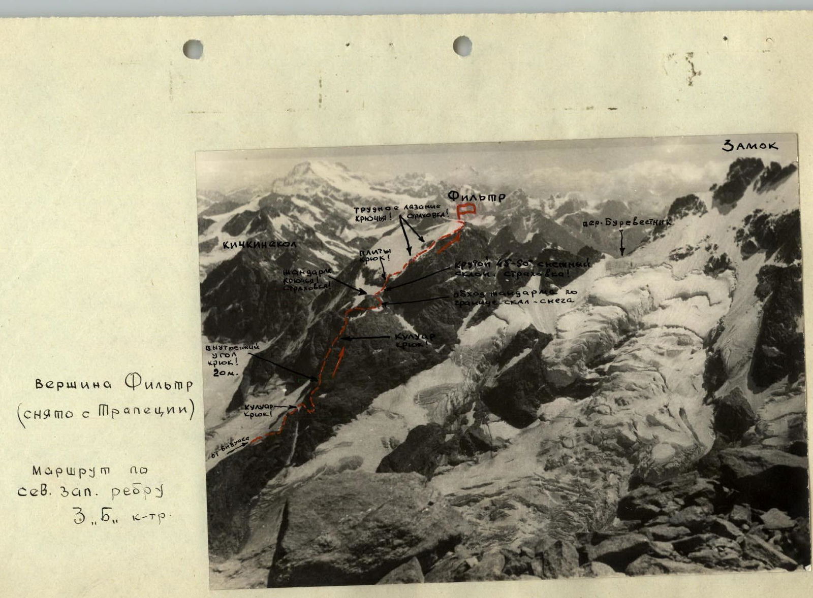
- Ascent to the summit of Filtr via the northwestern edge Cat. 3B See the path to the bivouac in the description of the Cat. 2B route
From the bivouac:
- along the stream on the right-upwards, under the rocks of the NW edge of Filtr peak;
- traverse the snowfield to the right-upwards and then along the slabs and "ram's foreheads" to the gorge (in rope teams!);
- from the gorge, exit to the snowy slope (35–40°) and along it to the rocky outcrop and beyond it along the snowy exit to the ridge.
From here:
- left-upwards 330–350 m to the snowy couloir;
- bypass the couloir to the right-upwards via the rocks to a large slab (protection! Hook!);
- from the slab, rounding the edge along the ledge, to the right — exit to the ridge (protection!);
- along the ridge 150 m to the internal angle and up it 20 m (protection! Hook!) — exit to the ridge;
- along the ridge 90–100 m to the yellow couloir.
Along the rocks of the couloir:
- first on the right, and then on the left — exit to the scree ridge;
- along it 90–100 m to the snowy bridge before the gendarme;
- the gendarme is bypassed on the right along the border of snow and rocks (protection! Hook!).
With the exit:
- left-upwards to the snowy bridge, turning into a 45–50° slope;
- along the slope (protection!) — to the black wet slabs;
- along the middle of the slabs via the destroyed rocks (rockfall — hazardous!) upwards to the snowfield (protection! Hook!);
- along the snowfield (protection!) — to the rocky belt.
Along the border of snow and rocks:
- exit to the left angle, to the ledge (protection! Hooks!);
- along it left-upwards, through the outer overhanging angle (2 hooks!) — to the upper large clearing.
From here:
- to the right to its end, under the overhanging slabs (hook for protection and receiving backpacks!);
- from the hook along the slab straight-upwards into a narrow crevice and then through the "window" — ascent to a large platform (protection!).